“TORONTO, Feb. 7, 2019 /PRNewswire/ – Adventus Zinc Corporation (TSXV: ADZN, OTCQX: ADVZF) (“Adventus”) is pleased to announce that is has entered into a heads of agreement to sell its Lismore, Fermoy, Millstreet and Charleville exploration projects in Ireland to the privately-owned Australian exploration company BMEx Limited … read the full press release on PRNewswire“
The above press release was published yesterday, and frankly I had to read it twice to make sure I had read it right. Essentially the Adventus Zinc Mining Exploration Company purchased the rights to mine the area around Millstreet, and sold it to an Austrialian mining company. Just like that.
So what’s going on, and where is the mine? Well there isn’t any mine, nor have any exploratory drill holes been sunk as of yet. The companies are trading on the hope of finding Zinc in the Millstreet area. (Ireland has the highest concentration of zinc in the world.
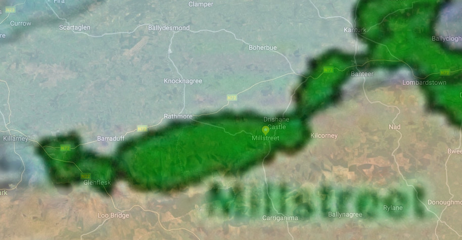
Why Millstreet? Millstreet lies right on top of the Killarney-Mallow Fault Line, a major fault line where two tectonic plates were pushing against each other 270 million years ago, which ended up forming the mountains south of here. In creating the mountains, the surface of the earth buckled and layers containing Zinc from deep underground were pushed up to the surface where they are remain to this day, available for mining.
It is no coincidence therefore that the map of the Millstreet Block (below) follows the fault line from Killarney to Banteer. Nothing might ever happen with mining … but you’d never know.