
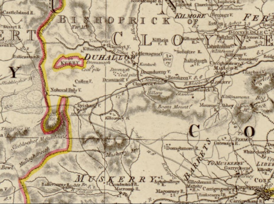
When looking at historical maps of the Millstreet area from the 18th Century, we noticed that Kerry extended into Ballydaly and a totally detached part of Kerry was just north of Cullen. Intrigued having never heard of this, we did some research, this is what we found out:
“Referred to as the East Fractions, they were exclaves of the barony of Magunihy in County Kerry. They existed from the suppression of County Desmond in the sixteenth century until 1843, when detached parts were transferred by Richard Griffith under the Valuation of Lands (Ireland) Act 1836 to the adjoining baronies. The fractions were part of the MacCarthy Mór territory from which Magunihy was delimited.”
It is not fully clear as to extent of the fraction around Ballydaly. Officially it was just the townlands of Balldaly and Kippagh, but it is mentioned elsewhere in different places that the Ballydaly fraction included Coolanarney and Coomacheo, and the old maps would seem to support this. We have recreated the map below showing the Ballydaly Fraction and the [read more …] “When Ballydaly was once part of Kerry”