
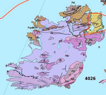
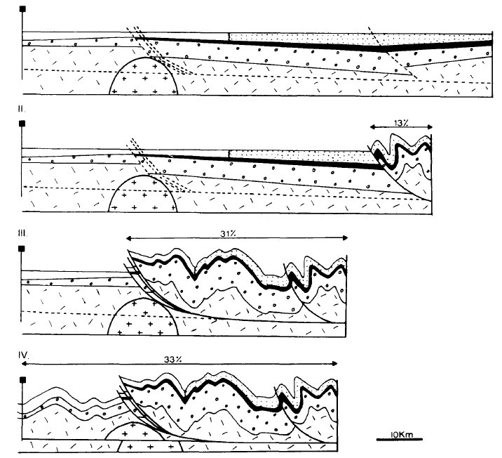
The large earthquake in Nepal this last week has been terrible for the people there, but most of us don’t know that in Millstreet, we actually live on a major fault line that was once as active as the any in the world. Referred to as the Killarney-Mallow Fault (KMF), it stretches from the Iveragh Peninsula in Kerry to the other side of Mallow and is the point where two continents were colliding. It is a reverse and thrust fault, and it resulted in folding of the rocks that created all the mountains of south of here.
This all happened 270 million years ago, so thankfully we get no serious earthquakes these days. The mountains were once almost three times as large, but they have since been weathered and scoured by glaciers during the ice ages, down to their current shapes, while the valleys have been filled in with debris.
Below are detailed maps and explanations and links to further detail: ==========
from CORK_GEOLOGY: Approximately 270 Ma during the Permian period a mountain-building event called the Variscan affected the rocks in Co. Cork. Two continents collided and the rocks were folded into a series of ridges (anticlines) and valleys (synclines) that have an east-west orientation. Across the ridges erosion as removed the younger rocks to expose the Old Red Sandstone while in the valleys the younger Carboniferous rocks still remain. By and large the rivers in Cork flow along the limestone synclines and in the west they have been drowned by seawater to form rias.


“Antiform near Millstreet in beautiful Ireland” [1]. This exposed rockface showing curved layers of rock, posted by by geologists S309 on twitter.
========
Bits and Pieces:
- The fault is referred to in places as the Killarney-Mallow Fault, and appears to be part of a longer line from Dingle to Dungarvan.
- The maps are not entirely perfect. When reseeding one field in 2002, there was a very distinct dividing line down through the field – on one side a light red, and on the other side, a darker browner soil. one of the boundaries between soil types above runs through that field, bue in a slightly different spot/angle.
- There have been no earthquakes locally in modern times (are we due one?). Update: actually an earthquake was reported in the Mallow / Kanturk area in 1868: “evere shocks of earthquake,
followed by a loud rumbling noise, were felt at two places near Mallow, in Cork county. It is stated that houses were much shaken, furniture was broken, and the occupants of the houses were greatly terrified. “(reported in the Aberystwyth Observer, 31 October 1868) - The great Lisbon Earthquake of 1755 was felt along the Mallow-Killarney Fault line.
- There has been much agreement & disagreement on the fault, but because it all happened in the past we probably will never know.
- I wish we had been taught local geology like this in school !
- The old red Sandstone of parts of suoth west Cork and south Kerry is from a time when the area was closer to the equator and which were large sand dunes – part of a large desert.
=======
Links:
- Map of Geological Faults in Europe
- Geological Survey of Ireland Public Viewer (interactive maps). Click on “Bedrock Datasets – Faults 500k / Bedrock 100K Solid Geology”
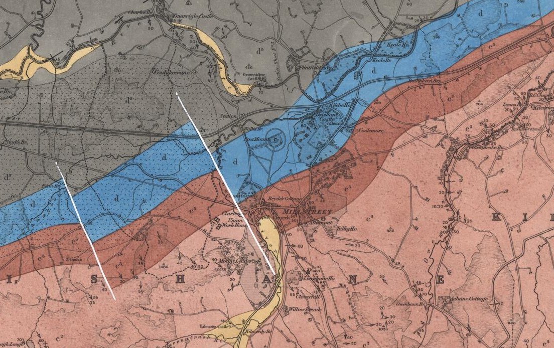
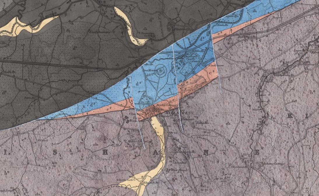
- Maps: Geological Survey of Ireland 1:63,360 geological map series (Maps etc from the 1800s) (1859 map) (1882 map)
- Geology of Cork
- Geology of Kerry
- Reverse – thrust fault [ref]
- Details on the Geology of Millstreet (1861)
- The structural evolution of the western Irish Variscides: an
example of obstacle tectonics? by Patrick A. Meere, Dept of Geloogy UCC 1995 - Influence of the Variscan and Caledonian orogenies on crustal structures in SW Ireland
- Earthquakes in the British Isles 1970 to present day
- Tremblor.net have a excellent map of fault lines around the world, which is being constantly updated
Congratulations Michael on your excellent article.Local geology is a core section of Transition Year Geography in Millstreet Community School..vital that students appreciate the unique geology of western Duhallow.