


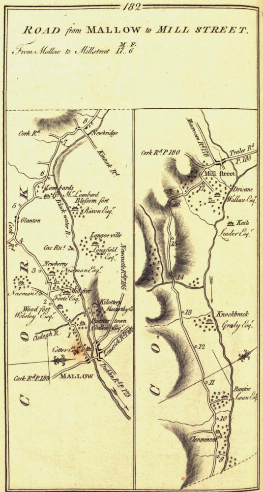
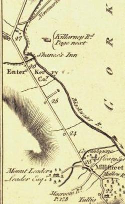


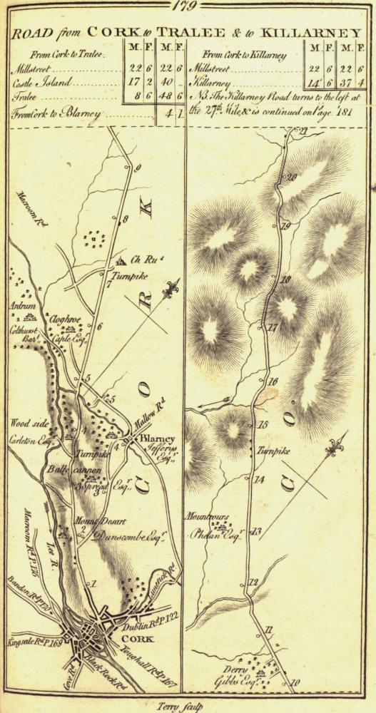
The images above are from the work of George Taylor & Andrew Skinner’s (both Scotsmen) entitled ”Maps of The Roads of Ireland”. Surveyed in 1777 and published for the authors on the 14th November 1778 in London. Millstreet is included in the roads,
- p178 Millstreet – Bandon
- p180 Cork -Millstreet – Castleisland – Tralee
- p182 Mallow to Millstreet
Click the images to see the the maps that include Millstreet. They all give a slightly different representation of Millstreet.
Notes: In 1776, they sought funding from Ireland’s noblemen and gentlemen in order to map the roads of Ireland. They succeeded in raising over £2,000 which paid for their survey costs, two additional surveyors and sixteen assistants, the engraving and the printing costs. They began their survey in February 1777 and completed it by the end of the year.
On askaboutireland.ie, you can read about the details of the Mapping and how it came to be.
It can be viewed online (and in different formats) at archive.org. It’s very big (105MB), and can also be downloaded from askaboutireland.ie
A few thoughts:
- The main roads obviously went through Millstreet at the time. When did Macroom become the gateway to Kerry from Cork? and, when did the main road near Cullen become the main road from Mallow to Killarney? ANSWERED (Dec ’14 by mdc): This road from Clonbanin Cross to Shinnagh Cross in Rathmore was mentioned as being “lately opened up by the government” before the publication of the Guide Through Ireland 1838 page 198. Planning for this new road and the “New Line” (33 miles from Castleisland to Roskeen) from is detailed in the Accounts and Papers of 1834: Experimental Improvements on the crown land Pages 18-24, at a price of £5,723, and £18,122 for the New Line.
- On the image showing the distances from Millstreet to other towns, note that there is a difference between the Irish mile and British mile.
- The typography of the time had the letter ‘s’ written very similar to an ‘f’
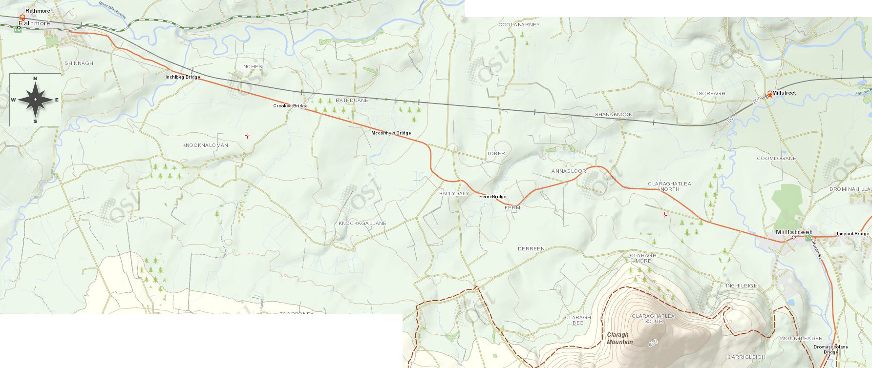
- The maps are obviously not entirely accurate, but it is funny how the road from Millstreet to Rathmore (p180) is mapped as being exactly straight. Oh we wish! (Update Jan 2015): acually the road from Millstreet to Rathmore was nearly dead straight. In the 1830s map of the area (see the map below), you can make out that there was a straight road from Tubrid to the Kerry side of Ballydaly that was dead straight (with lots of hills and hollows). Nowadays much of it is not much more than a farm track.